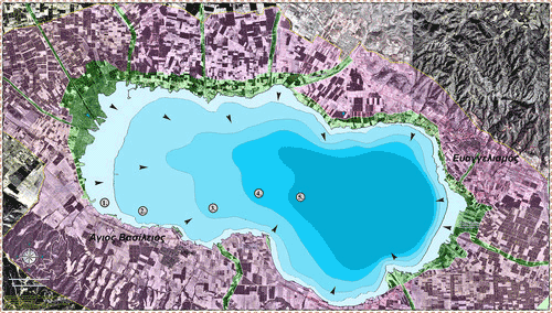
Application of satellite imagery in monitoring the lake Koronia shoreline change (North Hellas)

The lake Koronia, located in central Macedonia, is one of the most important biotope of our country. The ecosystem of the lake is a protected area based on the Ramsar, Natura 2000 and the 79/409 European directive. Nevertheless, the Koronia Lake, during the last years and more specifically after 1990, is experiencing strong pressures from irrigation and industrial activity, resulting in a continuous fall regarding its quantitative and qualitative characteristics.The current work focuses on the study of the environment of the lake based on satellite data of 4 Landsat images and the use of Geographical Information Systems. More specifically, the time and space evolution of the lake system during the last decade was maped, using the most appropriate techniques and having as a starting point the situation of the lake in 1970.


